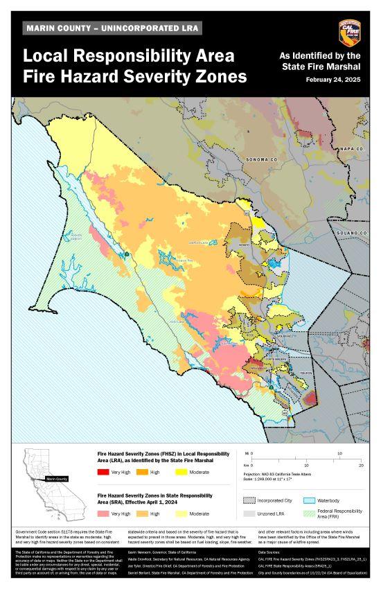
On February 24, 2025, the State of California released updated Fire Hazard Severity Zone (FHSZ) maps, which identify wildfire hazard areas within both State Responsibility Areas (SRAs), such as Marinwood Open Space, and Local Responsibility Areas (LRAs). As required by State law, Marinwood Community Services District must adopt these maps via Ordinance. Marinwood CSD Ordinance 2025-01 and the associated LRA FHSZ Map were introduced and first read at the Marinwood CSD Board of Directors meeting conducted on May 13, 2025. Ordinance 2025-01 and the associated LRA FHSZ Map were formally adopted at the Marinwood CSD Board of Directors meeting conducted on June 10, 2025.

For Additional Information and to View an Interactive FHSZ Map: Fire Hazard Severity Zone Map (opens State website)
Marinwood CSD Ordinance 2025-01 to Designate Fire Hazard Severity Zones in Local Responsibility Areas (opens seperate webpage)

